Part I: Research
The first step for this project was to understand how and why neighborhoods fall victim to gentrification. As cities grow and change, it is clear that some neighborhoods are neglected while others are championed. Often times these forgotten areas are home to working class people of color. As property values decrease, investors become interested in potential areas for redevelopment that would offer significant returns on their investment. Thus, the gentrification cycle begins. The question then arises, what happens to all of the people currently living in these neighborhoods? Historically, relief efforts take shape in the form of large housing projects. While these projects may seem well-intentioned on the surface, they often contribute to further segregation and inequality. Both negative and positive strategies were studied to promote further understanding of how to successfully provide inclusive and appropriate housing for households along the entire spectrum of income levels. Finally, a survey of successful public spaces was conducted. They ranged in size, scale, and duration, however this precedent study provided an informative snapshot of how a diversity of cities around the world are responding to similar issues.
Click on the photos below to dive in to each topic in more detail.
Click on the photos below to dive in to each topic in more detail.

GentrificationUnderstanding the causes of urban inequality, the desire for physical and social improvement, and who is affected by urban design.
Pictured: Homeless encampments under the elevated train in Kensington, Philadelphia. Photo Credit: Emma Lee/WHYY
|
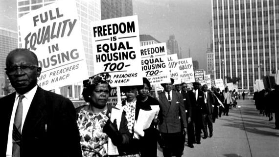
Affordable HousingExploring strategies for helping those in need, improving standards of living, and integrating communities of all races and economic statuses.
Pictured: Detroit Walk to Freedom Rally in 1963. Image sourced from Google Images.
|
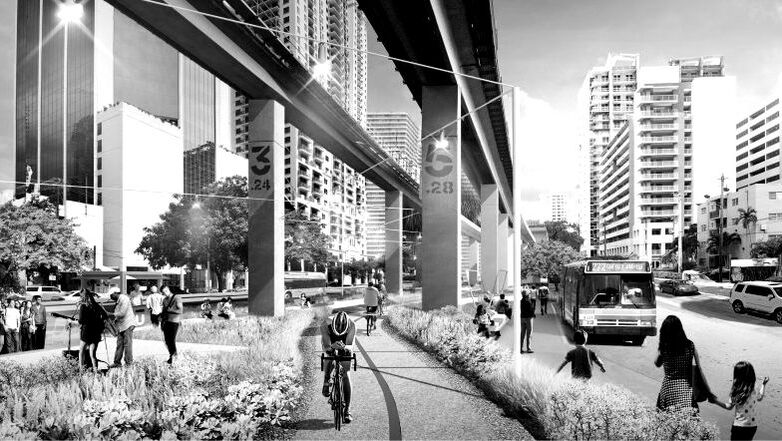
Urban Renewal StrategiesStrategizing ways to quickly and effectively improve urban living conditions for those present today and those who will come tomorrow.
Pictured: Rendering for Miami's 10 mile linear park master plan, The Underline. Master Plan by James Corner Field Operations
|
